GoogleMaps Polygon Integration
DB Services
Summary
Product Type: Extensions
Price: Free
Last updated: 1/25/2022
Language: English
Product websiteCategory
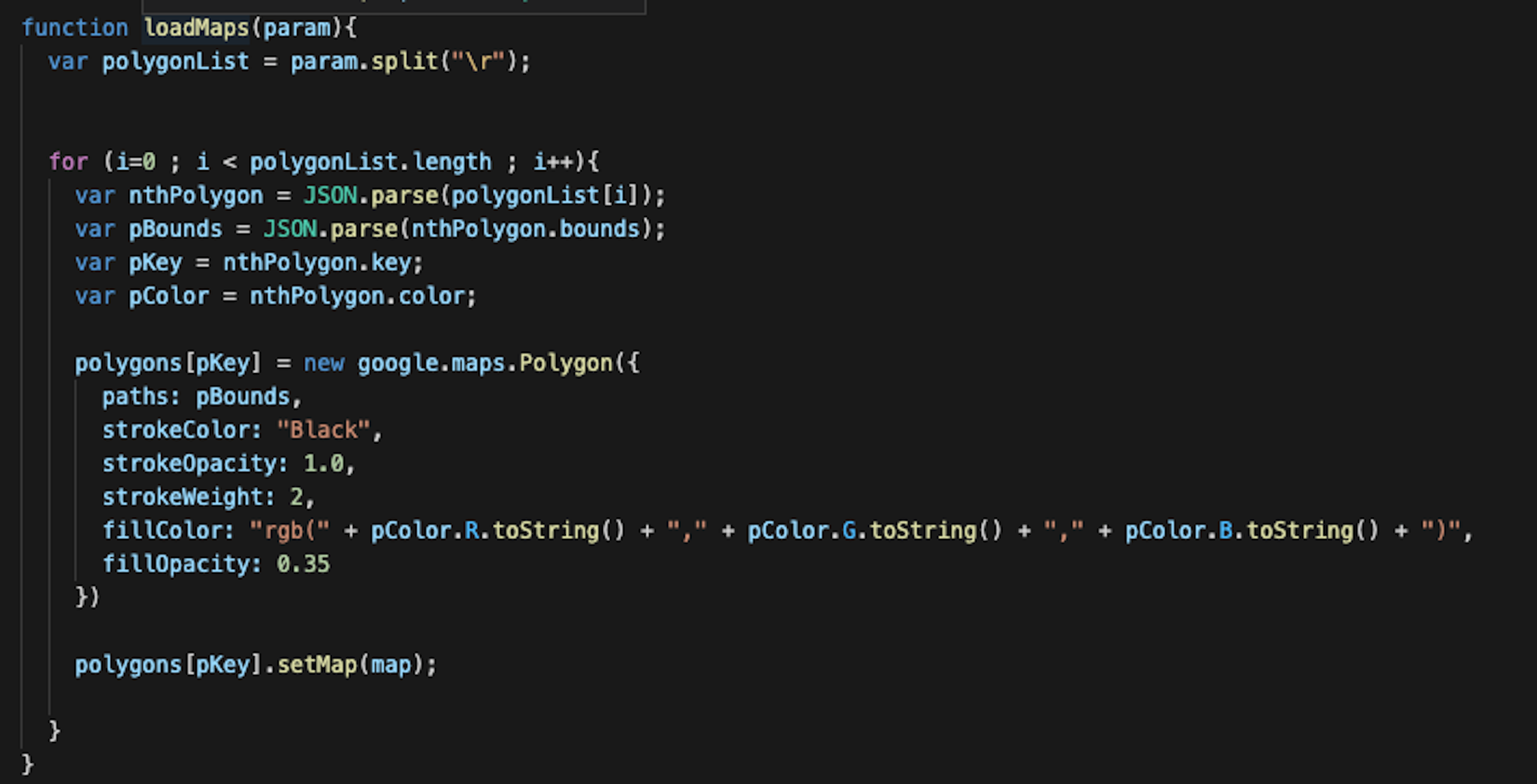
Display important geographic information in FileMaker
Display important geographic information in FileMaker using Google Maps JavaScript API Polygons.
Google offers a plethora of APIs to integrate different Maps features in custom solutions, including polygons. In this article, we will demonstrate how to display important geographic information in your FileMaker solution using the Google Maps JavaScript API polygons feature. Includes a video and sample file.
Additional resources
Claris product features
See why Claris products are the top choice for developers for their low code needs.
Product resources
Get instant access to helpful resources and start creating custom apps today.